With support from

|
|
|
| |
REGIONAL LINKS DIRECTORY
|
|
|
|
| |

Welcome to the GIN regional links directory.
The regional directory is categorised under nine major geographic regions. Each region contains
a list of websites specifically relating to the chosen region.
All websites listed here have been individually chosen based on their quality of content and
appropriateness to the specific region they represent. All links contained within this directory
are regularly checked to ensure they are currently available and do not lead to broken or missing
links. If you do happen to come across a broken link please let us know - email
our webmaster describing the
offending link and we promise to attend to it at our earliest opportunity.
|
|
|
|
ANTARCTIC
The world's coldest and most inaccessible region consists of an ice-covered continent, Antarctica, centred on the South Pole and surrounding this, the vast Southern Ocean, which is largely covered by floating pack ice. The Antarctic is much colder than the Arctic and its only inhabitants are visiting scientists. Various nations claim different parts of the Antarctic mainland. In 1959, twelve nations signed the Antarctic Treaty and agreed that Antarctica should be used for peaceful purposes only.
|
 | |
|
|
|
ARCTIC
The Arctic is an ocean more or less surrounded by land - just the opposite of the Antarctic, which is a huge land mass surrounded by water. The Arctic region generally refers to a rather large land area round the North Pole but the ocean is nearly five times as large as the Mediterranean and is covered with drifting ice which is sometimes 30m thick. Between Greenland and the Canadian mainland is Baffin Island, together with many smaller islands.
|
 | |
|
|
|
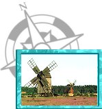
BALTIC
An inland sea of northern Europe, the Baltic is nearly 1,600km in length. It lies between Sweden on the west, Finland and the former USSR on the east, and Poland and Germany on the south. It has three main gulfs - the Gulf of Bothnia, the Gulf of Finland and the Gulf of Riga. Navigation in the Baltic has never been easy. The Danish channels and many of the harbours are too shallow for larger ships and wide areas are regularly frozen over for two months of the winter.
|
 | |
|
|
|
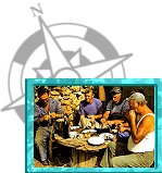
CARIBBEAN
The Caribbean Sea is bounded by the West Indies, the east coast of Central America and the north coast of South America. It is nearly 2,400km long and from 650 to 1,100km wide. The many islands surrounding the Caribbean are really the peaks of mountains submerged beneath the sea. After the completion of the Panama Canal in 1914, this sea became one of the busiest waterways in the world, lying on the main route between the Atlantic and Pacific oceans.
|
 | |
|
|
|
|
|
INDIAN OCEAN
 African Ocean Portal
Agulhas and Somali Current Large Marine Ecosystems (ASCLME) Project
AUF Indian Ocean Bureau
Bay of Bengal Large Marine Ecosystem Project
Bay of Bengal Programme
Collaborative Actions for Sustainable Tourism (COAST)
Coral Reef Degradation in the Indian Ocean (CORDIO)
DLIST Agulhas and Somali
Foundation for the Protection of Marine Megafauna
Indian Ocean Climate Initiative
Indian Ocean Climatology & Oceanography Gateway
Indian Ocean Commission
Indian Ocean Experiment
Indian Ocean Portal
Indian Ocean Research Group
Indian Ocean Rim Association for Regional Cooperation
Indian Ocean Tuna Commission
Indian Ocean-Southeast Asian Marine Turtle MoU
IOC Acclimate
IOC Agriculture & Biodiversity Portal
IOC Environment & Natural Resources Portal
IOC Islands Project
Ocean Data and Information Network of Africa
SAARC Coastal Zone Management Centre
Sea Sense
Seabiome Indian Ocean
SeaweedAfrica
Society for Indian Ocean Studies
South West Indian Ocean Fisheries Project
UN Agencies in Mauritius and Seychelles
UNEP Nairobi Convention
Western Indian Ocean Fisheries Database
Western Indian Ocean Marine Science Association
|
 | |
|
|
|
MEDITERRANEAN
The Mediterranean Sea is almost landlocked, being joined with the open Atlantic Ocean only by the narrow Strait of Gibraltar. It lies between Europe and Africa and is more than 3,220km long. The north side of the Mediterranean is broken up by the Adriatic and Aegean seas as well as by the peninsulas of Italy and Greece. Most of the islands are in the northern part of the sea. In 1869 the Suez Canal was opened, thus making the Mediterranean the shortest sea route between Europe and the East.
|
 | |
|
|
|
NORTH ATLANTIC
The northern half of the world's second largest ocean is rich in islands, varied coastline and tributary seas. On the west are the Caribbean, the Gulf of Mexico, the Gulf of St. Lawrence, Hudson Bay and Baffin Bay. To the east are the Mediterranean, the Black Sea, the North Sea and the Baltic Sea. As well as purely oceanic islands there are those which rise from the Mid-Atlantic Ridge, including the Azores. Other islands such as The Canaries and Madeira rise from Africa's continental margins.
|
 | |
|
|
|
PACIFIC
The Pacific is the largest and deepest of all the oceans with an area of 165 million square kilometres, an area greater than that of all the world's lands put together. At its greatest width the Pacific measures 17,220km. It extends from the Bering Straits of the Arctic Circle, to Cape Adare, Antarctica, a distance of 15,450km. There are very few islands in the eastern Pacific. Its northern and western borders are fringed with chains of islands including The Aleutians, The Kurils and the Ryukus. The Inner Pacific islands are divided into three main groups - Melanesia, Micronesia and Polynesia.
|
 | |
|
|
|
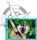
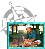
SOUTHEAST ASIA
Southeast Asia is the name for the peninsular area of the Asian continent that lies between India and China, and stretches south along a chain of islands towards Australia. The countries of mainland Southeast Asia are Malaysia, Burma, Vietnam, Laos, Kampuchea, Thailand and Singapore. Further south lies insular (island) Southeast Asia. This is made up of thousands of islands containing the countries of the Philippines, Brunei, Indonesia and East Timor.
|
 | |
|
|
|


